")
")

![]()
Protected areas
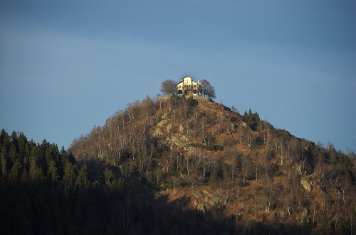
VAL GRANDE NATIONAL PARK
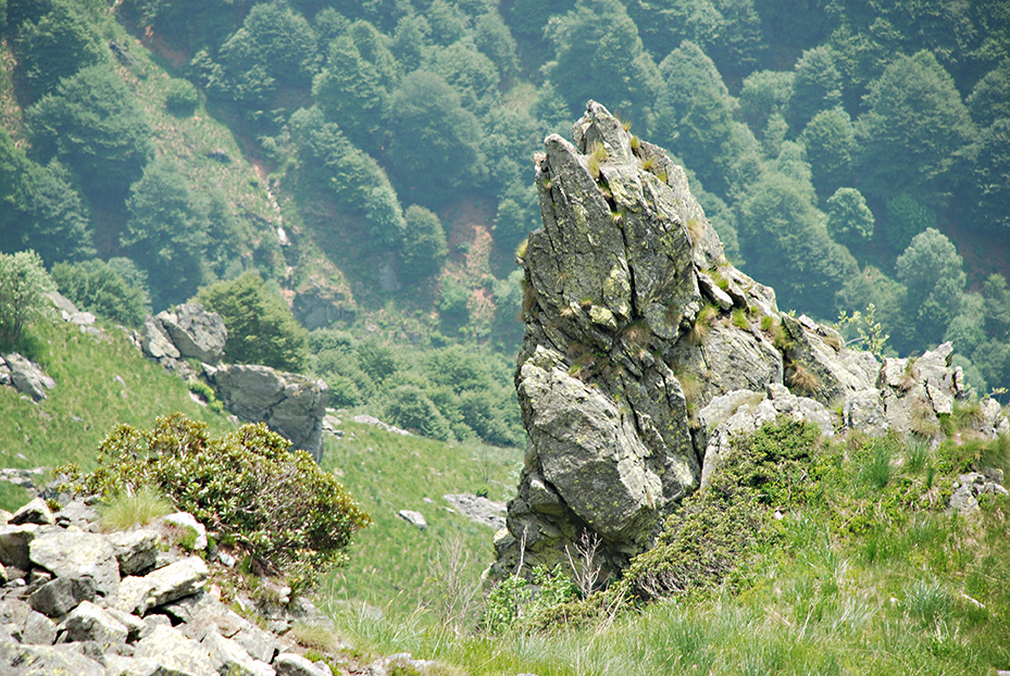
Val Grande National Park, surrounded by the Ossola mountains and Lake Maggiore, protects the "largest wilderness area in Italy". Here the word “wilderness” does not indicate wild places that have never been affected by human presence: here wilderness means the slow return of nature after the end of human activities. Woodcutters and shepherds lived in this area until the end of the Second World War and traces of past human presence are still evident: mule tracks, mountain pastures, terraces, remains of cableways but also ancient engravings on the rocks. After the abandonment of the valley, nature reclaimed the area and within 50 years the territory has assumed a rugged and wild aspect. In 1977 Val Grande was identified by the Italian Association for Wilderness as one of the most interesting wild areas at international level, although the idea of creating a park had already been born in the early 50s and in 1971 the integral Nature Reserve of the Pedum and the Mottac Nature Reserve were recognized.
Val Grande National Park was established on 2 March 1992, on the territory of the municipalities of Beura Cardezza, Caprezzo, Cossogno, Cursolo Orasso, Intragna, Malesco, Miazzina, Premosello Chiovenda, San Bernardino Verbano, Santa Maria Maggiore and Trontano. In 1998 the protected territory was expanded to include the hamlet of Colloro and part of the municipalities of Aurano and Vogogna.
AUTHORITY FOR MANAGEMENT OF THE SESIA VALLEY PROTECTED AREAS
This was established on 1 January 2012 for the management of only Alta Valsesia Natural Park and Monte Fenera Natural Park: Alta Val Strona was also entrusted to the new authority, thus incorporating into the protected area an important part of the Cusio mountains.
![]() Alta Valsesia Natural Park
Alta Valsesia Natural Park
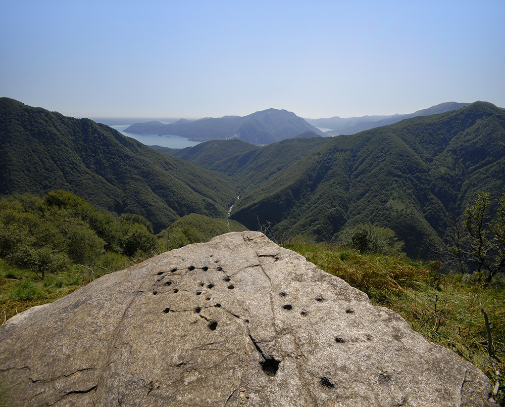
Alta Valsesia Natural Park, established in 1979, protects a territory that extends for about 6500 hectares; it occupies the upper Sesia, Sermenza and Mastallone valleys, which are part of the municipalities of Alagna, Rima, Carcoforo, Rimasco, Fobello and Rimella. The protected area extends up to 4559 m on the Gnifetti peak of the Monte Rosa massif: this can be considered an alpine park par excellence and is the highest park in Europe.
In much of the area, the shapes in the landscape have been made by the action of the glaciers, which for centuries have been the predominant element of the Sesia Valley and still today make the scenery of the territory of Alagna extraordinarily evocative. The presence of glaciers influences the ecosystem of the park, characterized according to the elevation by larch, which forms woods in Alagna and Carcoforo, by alpine meadows and, even higher, by pioneer species in the most extreme environments; in the areas of the Mastallone valley a mixed beech and silver fir wood predominates. In the park the typical alpine species find their ideal habitat: ibex, chamois, marmots, roe deer, black grouse, different hares and golden eagle.
 Natural Park of Monte Fenera
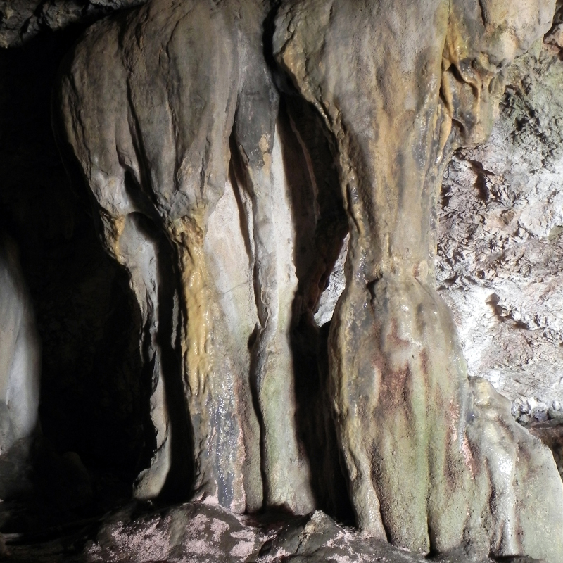
It takes its name from Mount Fenera, a solitary hill with a rounded shape that stands out in the lower Sesia Valley, clearly visible from the plains of Novara and Vercelli. Established in 1987, the park covers about 3378 hectares. The presence of carbonate rocks, infrequent in Valsesia, is highlighted by numerous caves, by the special flora and by some archaeological evidence, both ancient and recent. In this treasure chest rich in natural rarities there is the typical vegetation of calcareous soils, where the alpine shrub (Daphne alpina), the wild vine (Vitis vinifera) and the hart's-tongue fern (Phyllitis scolopendrium) stand out. Even among the animals we can find uncommon species, such as the very rare black stork, wallcreeper, and peregrine falcon. The caves are located on the western side of the park: some are very important from the archaeological and palaeontological point of view because there are signs of the presence of Neanderthals, about 50,000 years ago, a place unique in the Piedmont; later also cave bear (Ursus spelaeus), which became extinct 20,000 years ago, took refuge in the caves of Fenera.
Information: www.areeprotettevallesesia.it
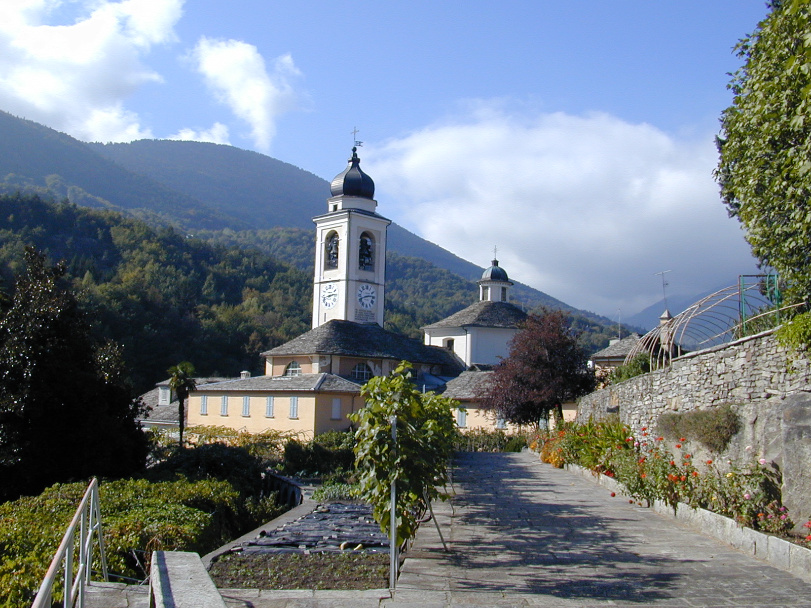
SPECIAL RESERVE OF THE SACRED MOUNT OF VARALLO
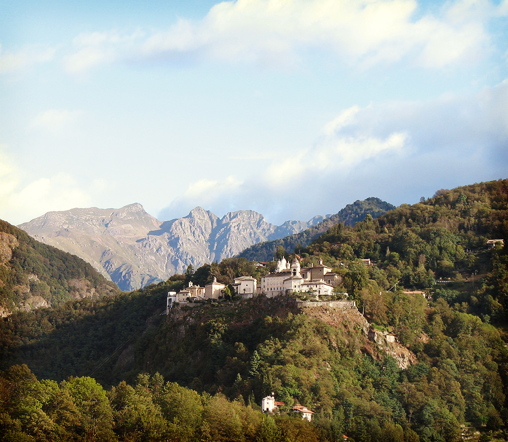
The Sacred Mount of Varallo, in the Sesia Valley, is located at 600 meters above sea level, on a spur of rock above the town of Varallo. It is an architectural and artistic complex, consisting of forty-five chapels and a church. The forty-five buildings are richly decorated with frescoes and life size sculptures showing the life of Christ. Paintings and statues were made between the late fifteenth and eighteenth centuries by the major Piedmontese and Lombard artists of the period: Gaudenzio Ferrari, Morazzone, Tanzio from Varallo, Giovanni d'Enrico and Dionigi Bussola.
The Sacred Mount is also a fine example of ornamental park, with areas of native trees but also specimen trees, organized in part according to typical Italian garden designs, with hedges and paths, and partly according to more naturalistic criteria as the beech wood of the so-called Vallone dell'Inferno (The Valley of Hell). The two historical squares reflects, on the other hand, the architectural concept of the "ideal town", realized with monumental buildings. Since 2003 the Sacred Mount of Varallo, together with the other six
Piedmontese Sacred Mounts (Belmonte, Crea, Domodossola, Ghiffa, Oropa and Orta) and the two Lombardy Sacred Mounts (Ossuccio and Varese), are part of the UNESCO list of "Sacred Mounts of the Piedmont and Lombardy regions”
This Sacred Mount is owned by the Municipality of Varallo and is also a Protected Area of the Piedmont Region, established in 1980, which protects, preserves and promotes it through the Sacred Mount Management Authority, into which the previous special Natural Reserves of the other Piedmontese Sacred Mounts have been merged since 2012.
Information: www.sacromonte-varallo.com
SPECIAL RESERVE OF THE SACRED MOUNT OF THE HOLY TRINITY OF GHIFFA
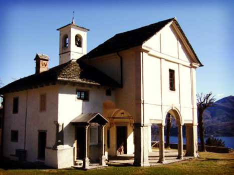
The Special Reserve of the Sacred Mountain of the SS. Trinità di Ghiffa is located on a natural terrace 360 meters above sea level, overlooking Lake Maggiore. The unfinished baroque architectural complex, by an unknown architect, is in approximately 200 hectares of Nature Reserve, which also has numerous paths and votive chapels. The place of worship already existed at the end of the 16th century, and was developed in less than two centuries. The fulcrum of the complex is the sanctuary dedicated to the Holy Trinity, built on the walls of an ancient Oratory. A management body has overseen maintenance of the buildings and the park, as well as the promotional aspects and the enhancement of the environment, since 1987.
Where there are no buildings, the area is entirely occupied by broad-leaved woodland, mainly of chestnut, together with oak, lime, maple, ash, birch, and alder together with shrub species such as yew, holly, butcher's broom, hazelnut and medlar. Coniferous plants, where present, are not spontaneous but they have been planted. This environment is home to various species of mammals, including roe deer, squirrels, foxes, dormice and badgers. Among the numerous species of birds are common buzzard, black kite, common kestrel, owls, woodpeckers, jay, nightingale, and hooded crow.
In the reserve there is a rich network of paths, which includes themed and interpreted trails and picnic areas; it is possible to carry out several educational, cultural, touristic and sporting activities both at the Sacro Monte or along the trails; the Tourist Reception Center, consisting of the Information Center and the Visitor Center, has been operating since 2002.
Since 2003, along with the other Piedmontese and Lombard Sacred Mounts, the Ghiffa site is part of the UNESCO World Heritage Site.
Information: www.sacromonte-ghiffa.com
SPECIAL RESERVE OF THE SACRED MOUNT OF DOMODOSSOLA
The Reserve was established in 1991 in order to protect the artistic, historical, architectural and natural heritage of the Sacred Calvary Mount of Domodossola. The complex consist of the Medieval Castle of Mattarella, the Convent of the Rosminiani Fathers, the Oratory of the Madonna delle Grazie, the Sanctuary of the Holy Crucifix and fifteen chapels of the via crucis (‘Way of the Cross’), which, starting from the Domodossola plain, reaches the Colle di Mattarella. This complex of historical, cultural and religious interest, created from the seventeenth century onwards, has been important for centuries, and especially so for religious reasons. In fact in 1656 two Capuchin of the Domodossola convent (Andrea da Rho and Gioachino da Cassano) proposed the construction of the Sacred Calvary Mount in memory of the passion of Christ and then, in 1657, the construction also of the Sanctuary of the Holy Crucifix. The hill which the Sacred Mount complex stands on has, however, a more ancient history: there is evidence of a fragment of an early Christian marble headstone, dating back to 539 AD; it is the oldest testament of the presence of Christianity in Ossola; a castle was built in the Lombard period (6th century) on pre-existing Roman structures, and this was enlarged in the following centuries. Around the architectural complex ancient terraces testify that in the past the land available for the religious community was cultivated both for agricultural production and for ornamental purposes.
Information: www.sacromonte-domodossola.com
NATURAL RESERVE OF THE FONDO TOCE
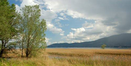
The Fondo Toce Nature Reserve was established in 1990: it includes the last section of the Toce river before it flows into Lake Maggiore, and part of the alluvial plain of FondoToce. It is a typical wetland, an important remnant of a humid environment in an area of intensive human settlement: this type of environment is now rare, as they have been drastically reduced by reclamation, but they are some of the richest and most precious environments from the point of view of nature. The reserve occupies an area of about 360 hectares, in the territory of the municipalities of Verbania (Fondotoce), Gravellona Toce and Baveno (Feriolo); it houses an important study centre on bird migration. Within the area a large reed bed is a resting and nesting point for numerous species of birds. The importance of this area is strengthened by the existence of an endemic plant species: water chestnut, found in the last part of the Fondotoce canal. The Reserve is managed by the Authority for the management of the protected areas of Ticino and Lake Maggiore, established in 2009, which in addition to the area of Fondotoce manages the Natural Park of Ticino, the Natural Park of the Lagoni di Mercurago, the Natural Reserve of the Canneti di Dormelletto and the Bosco Solivo Nature Reserve.
NATURE RESERVE OF BARAGGE
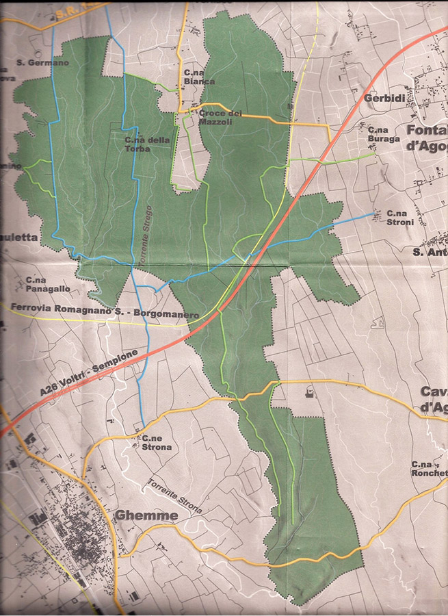
Inside the geopark we find environments that are surprisingly similar to the African savannah: they are nicknamed "savannah of Biellese" and are the so- called “Baragge”. On the eastern side of the river Sesia, in the triangle between Gattinara, Romagnano and Ghemme, there is the “baraggia” of Piano Rosa, while in the municipalities of Gattinara, Lozzolo and Roasio there is part of the “baraggia” of Vercelli.
These are plateaus formed by the remains of ancient and vast plains, built by fluvioglacial and river deposits accumulated between 750,000 to 135,000 years ago (Middle Pleistocene) after the erosive action of torrents and glaciers on the mountainous and hilly areas.
Subsequently, the fluvial network was deepened, eroding and dismantling most of these plains, generating other more recent deposits at lower altitudes and leaving only some raised edges of the ancient plains. These ancient deposits were also covered by a thin and discontinuous layer of ‘loess’, yellowish sands and silts transported by the wind. In some areas there are also older deposits, of river delta and marine origin, often containing fossils: they testify to the presence of a large marine gulf, between 5.2 and 1.8 million years ago.
The typical vegetation of these environments consists of grasslands and moors where high grasses prevail, but there are also wooded areas.
The “baraggia” environment is particularly suitable as a habitat for birds: 167 species have been recorded, of which about seventy breed; some of these species are now rare in the Po Valley.
Information: https://www.parcoticinolagomaggiore.com
OASIS
Oasi Zegna
This project for the enhancement and protection of the environment began in 1993, naturally following on from the project that Ermenegildo Zegna, a textile entrepreneur, started in the 1930s in the territory surrounding the town of Trivero, the site of the Ermenegildo Zegna Factory. Today it is an area of the Biella Alps, about 100 km2 wide, located between Trivero and the nearby Valle Cervo and offering accommodation and sports facilities, thematic routes with information panels, as well as many cultural activities.
Inside the area the "Panoramica Zegna" road connects Trivero to the Valle Cervo and offers an exceptional view of the Po plain, from the peaks of Lombardy to the pyramid of Monviso.
The symbol of the Oasis is an endemic beetle of the area, the rare Carabus olympiae: highly coveted by collectors, it risked becoming extinct in the 90s but is now protected thanks to the European LIFE Carabus project.
The Oasi Zegna obtained, in 2014, the patronage of the FA, Fondo Ambiente Italiano, with which it collaborates in projects for the enhancement and protection of the environment.
Information: www.oasizegna.com
Bosco Tenso Natural Oasis
The oasis of Bosco Tenso, in the municipality of Premosello Chiovenda, covers about 22 hectares and was established in 1990 on an area of municipal property; it is protected by a landscape restriction.
This educational oasis is managed by the WWF in collaboration with the municipality: inside there is a nature trail with panels and boards, an outdoor teaching room, a hide from which to observe wildlife, rest areas and benches, and also there is an area equipped with a kitchen and large covered areas.
The land on which the "Tenso Wood" extends is alluvial: sandy gravel at depth; silty sand at the surface due to the periodic flooding of the river Toce which, together with the "Rio dei Rughetti" and the "Rio del Ponte", keeps the soil moist.
The whole area is covered by a dense mixed deciduous forest that follows the course of the Rio dei Rughetti for a good part of its length. There are 40 species of nesting birds and also many different species of butterflies.
It is an other long list; I think it's not worth it to waste so much time in this kind of translation, now.
Information: www.comune.premosello.vb.it
"Pian dei Sali" naturalistic oasis
The WWF Oasis "Pian dei Sali" is a flat area located in the municipality of Malesco, in Val Vigezzo, located after the hairpin bends of Scopello and before reaching the hamlet of Finero. It is about one and a half hectares of plateau characterized by a typical humid mountain environment with large numbers of brown-yellow skinned European common frogs: this amphibian can even live above 2500 meters.
Mammals include roe deer, chamois and other deer, and foxes. Birds include woodpeckers, eagle owls and larks.
The slopes around the oasis are covered by conifers and woods of broadleaved trees; inside there is also an area of geological interest.
The Oasis is open to the public from spring to autumn, with its nature trail, picnic area and sports field. And, unusually, there is a “human-sundial”, where the person's shadow indicates the hour engraved in stone.
Information: www.vallevigezzo.eu/il-pian-dei-sali/
Parco Nazionale Val Grande
This email address is being protected from spambots. You need JavaScript enabled to view it.
Ass. Sesia Valgrande Geopark
This email address is being protected from spambots. You need JavaScript enabled to view it.
Ente di Gestione delle Aree Protette della Valle Sesia
This email address is being protected from spambots. You need JavaScript enabled to view it.